
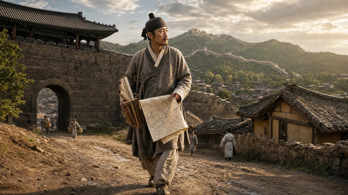
A life sketched from the edges of history
In the story of modern Korea, certain names carry an almost mythic force. King Sejong, the 15th-century ruler associated with the creation of the Korean alphabet, is one. Admiral Yi Sun-sin, the naval commander celebrated for resisting Japanese invasions, is another. Kim Jeong-ho belongs in a different but still distinguished category: He is remembered not for ruling or fighting, but for trying to understand his country in exacting physical detail.
Kim, believed to have been born around 1804 and to have died around 1866, is widely regarded as one of the most important geographers and cartographers of the late Joseon Dynasty, the kingdom that ruled the Korean Peninsula from 1392 to 1897. For many Koreans, his name is inseparable from the Daedong Yeojido, a landmark 19th-century map of Korea that has long stood as a symbol of scholarly rigor and national knowledge. But reducing Kim to a single famous map misses the larger story. He was not a one-work genius who appeared out of nowhere. He was a persistent compiler, reviser and researcher whose life’s work unfolded across decades.
What makes Kim especially compelling to modern readers is not just the quality of his maps, but the social distance he appears to have traveled to make them. Historical records suggest he came from modest means in Tosan County, in what was then Hwanghae Province. That matters in Joseon society, which was formally hierarchical and deeply shaped by status. Scholars and officials typically came from the yangban elite, the hereditary upper class that dominated political and intellectual life. Kim’s exact status remains uncertain. Historians have suggested he may have belonged either to a fallen branch of the yangban or to the middle technical class known as the jungin, but no decisive record settles the matter.
For American readers, one useful comparison is to think of him as a self-made researcher working in a world where access to knowledge, patronage and social standing was tightly controlled. He did not emerge from something equivalent to an Ivy League pipeline. Instead, he appears to have built authority through relentless labor, technical skill and an unusual devotion to geographic knowledge. That helps explain why his legacy has endured. In a culture where lineage often mattered deeply, Kim came to be remembered for mastery.
Even basic details about his personal life are frustratingly difficult to pin down. He left behind very little autobiographical writing, so his life has to be reconstructed through the works he compiled and references by other people. That means the Kim Jeong-ho known today is visible mostly through his output: books, maps, prefaces and the testimony of later observers. In some ways, that deepens the fascination. He appears to us not as a self-promoting public figure, but as a craftsman-scholar whose identity is embedded in the precision of his work.
From rural Hwanghae to the capital outside the South Gate
Though Kim was born in Hwanghae Province, he eventually made his way to Hanyang, the city now known as Seoul and then the capital of Joseon. Scholars do not know exactly when he left his hometown, but later accounts consistently place him in the neighborhoods outside the city’s South Gate, or Namdaemun. That geographical detail may seem minor. It is not. In a city defined by gates, walls and status boundaries, where one lived helped locate a person socially as well as physically.
Accounts tied to people who knew of Kim place him around Manrijae, a hill area outside Namdaemun. A 1925 newspaper article also recorded efforts to erect a memorial stone near his old home site in Yakhyeon, another area just outside the South Gate. Some sources mention Gongdeok-ri, outside Seodaemun, the West Gate, but that appears to stem from confusion over place names rather than firm evidence. The broader pattern is fairly consistent: Kim seems to have built his life in the southern outskirts of the capital.
To translate that into terms more familiar to American readers, imagine an influential researcher associated not with a grand address in the center of power, but with the working margins just beyond it — close enough to the capital’s institutions to participate in intellectual life, yet socially and geographically outside the ceremonial core. It is a reminder that great knowledge projects are not always born in official chambers. Sometimes they take shape in less glamorous neighborhoods, assembled by people working with fewer resources than their importance would later suggest.
That Kim lived outside the South Gate also helps humanize a figure often flattened into legend. He was not merely a name attached to an old artifact in a museum. He was a resident of a very real urban landscape in 19th-century Korea, moving through roads, markets and neighborhoods that connected the capital to the wider country he spent his life documenting. There is something fitting about a mapmaker living on the threshold between center and periphery, between the walled city and the roads leading out of it.
His reported death around 1866 from a lung-related illness in Yakhyeon, again outside Namdaemun, closes the circle. If the surviving accounts are correct, the same area that anchored his working life also became the place of his final years. The man who tried to organize the geography of an entire kingdom seems to have lived and died in one small part of its capital, surrounded by the terrain of ordinary life.
An early obsession that became a lifetime’s work
One of the clearest themes in the surviving record is just how early Kim’s interest in geography began. A text connected to the scholar Choe Han-gi says Kim had already set his mind on maps and regional geography by the age of 18 or 19. That is notable because geography in his world was not simply about drawing territory. It joined together visual representation and written description. A map showed land and routes; a geographic treatise explained the characteristics of places, distances, administration, local products and spatial relationships.
This distinction matters because Kim did not seem to treat maps and written geography as separate specialties. He approached them as mutually reinforcing forms of knowledge. That sounds intuitive today, in an era when Americans check a digital map while also reading neighborhood reviews, transit guidance and historical background. But in Kim’s time, the integration of graphical and textual geographic knowledge required painstaking manual compilation, correction and cross-checking.
His known scholarly activity becomes visible by 1834. Around that time, he completed an initial version of Dongyeodoji, a geographic text, along with the map known as Cheonggudo, which functioned as a cartographic companion. The pairing is important. Rather than producing a map as a standalone visual object, Kim was already building a system in which written regional description and spatial depiction supported each other.
And he did not stop there. Around 1851, he compiled Yeodobiji, another geographic work. Around 1856, he produced Dongyeodo, another map. The pattern across these titles tells us something essential about his method. He was not pursuing isolated projects. He was engaged in a long process of refinement, revisiting old material, updating information and bringing map and text into closer alignment over time.
For readers used to thinking of scholarship as a series of polished final products, Kim’s process may feel surprisingly modern. It resembles iterative research — draft, review, revise, expand — more than the romantic image of a solitary genius producing a masterpiece in a single burst. In that sense, Kim’s career belongs to a broader history of knowledge-making: the slow accumulation of credibility through repeated correction.
That is part of why his story continues to resonate in Korea. The appeal is not merely national pride in an old map. It is also admiration for disciplined intellectual labor. Kim’s life suggests a man who found his calling young and then spent decades pursuing it with a consistency that outlived fashion, circumstance and perhaps even recognition during his own lifetime.
The map that made his name
If Kim Jeong-ho is known to the general public today, it is chiefly because of the Daedong Yeojido, compiled in 1861. In Korean historical memory, the map occupies a place somewhat analogous to what a foundational survey or canonical atlas might hold in the American imagination — not identical in purpose, but comparable in symbolic weight. It represents an effort to see the country whole.
The map did not materialize suddenly. By the time Kim produced it, he had already spent decades working on earlier maps and geographic texts. The Daedong Yeojido is best understood not as an isolated achievement but as the culmination of a long chain of revisions reaching back to the 1830s. Kim appears to have used earlier works such as Cheonggudo and Dongyeodo as foundations, refining and improving them in the process of creating what became his best-known work.
That long gestation matters because it changes how we see the map. It was not simply a feat of technical drawing. It was the distilled product of decades spent gathering, organizing and checking geographic information. Kim’s achievement lay as much in synthesis as in illustration.
To appreciate why this mattered in 19th-century Joseon, it helps to remember that accurate geographic knowledge was tied to governance, travel, taxation, military movement and administrative control. Maps were not neutral decorations. They were tools of statecraft and instruments of understanding. In a premodern kingdom facing internal strains and growing external pressures, the ability to describe the land with greater coherence carried both practical and intellectual significance.
Americans might compare the cultural prestige of Kim’s map to the way the Lewis and Clark expedition or the U.S. Geological Survey entered the national story as symbols of making territory legible. The analogy is imperfect. Joseon Korea was not a sprawling frontier republic expanding westward. It was a long-established kingdom with its own bureaucratic traditions. Still, the emotional connection is similar: mapping is never only about space. It is about how a society understands itself.
That helps explain why Kim remains so prominent. The Daedong Yeojido is not remembered merely because it is old. It is remembered because it embodies a way of knowing the country through precision, patience and revision. In a Korean context, it became a touchstone for scholarly seriousness and a reminder that even under the constraints of a rigid social order, extraordinary intellectual work could emerge from outside the highest ranks of power.
More than one masterpiece: correcting, revising and arguing with the record
Kim’s work did not end with the completion of the Daedong Yeojido. According to historical accounts, he continued compiling geographic material and by 1866 had worked on Daedong Jiji, a large-scale geographic text said to fill 32 volumes in 15 books. Its purpose was not simply to restate existing knowledge. It aimed to correct errors and supply omissions in an earlier official Korean geographic compendium, the Sinjeung Dongguk Yeoji Seungnam.
That point deserves emphasis because it reveals Kim’s intellectual temperament. He was not content to preserve inherited knowledge uncritically. He appears to have approached prior records as imperfect materials to be examined, challenged and improved. In modern newsroom terms, he was not just rewriting the file; he was checking the file against reality and noting what the archive got wrong.
There is something strikingly contemporary in that attitude. Good reporting, good scholarship and good cartography all depend on the same basic principle: Verification matters more than repetition. Kim’s significance lies not only in the beauty or utility of his maps, but in the fact that he kept revising them and testing written records against other sources. He treated knowledge as provisional and correctable.
That approach is especially important when considering how geography functioned in premodern East Asia. Textual authority could be powerful. Once an official work was compiled, later generations might defer to it. Kim’s willingness to identify mistakes and gaps suggests confidence in method and a commitment to accuracy that rose above simple reverence for precedent.
It also reinforces the idea that his maps and texts were inseparable. He did not produce written geography over here and visual cartography over there. He moved back and forth between them, using each to test and support the other. This was not just a technical habit; it was a worldview. For Kim, a place had to be both described and seen, explained and located.
That is one reason scholars still regard him as the representative geographer and mapmaker of late Joseon. His legacy rests on sustained, interlocking work rather than on a single act of genius. If the Daedong Yeojido is the public monument, the deeper foundation beneath it is the decades-long practice of compilation, correction and integration.
What Kim Jeong-ho tells us about Korea before modernity
Kim’s life opens a revealing window into Korean society in the 19th century, a period often overshadowed in Western discussions by the more dramatic events that came later: Japanese colonial rule, the Korean War, authoritarian modernization and the rise of South Korea as a global cultural and economic force. Yet the Korea of Kim Jeong-ho’s time was already a complex world of class hierarchy, urban migration, regional identity and ambitious knowledge production.
Joseon was a Confucian state with a powerful bureaucracy and a highly developed literary culture. Education and civil service examinations were key routes to prestige, but access to those routes was uneven. That is why Kim’s apparent rise from a poor background carries such weight. Whether he was a ruined member of the gentry or a specialist from the middle ranks, he appears to have operated from outside the most secure forms of elite privilege.
His story also underscores the importance of geography in a kingdom often stereotyped abroad as static or inward-looking. Korea before modern industrialization was not devoid of systematic inquiry. On the contrary, Kim’s works show a sophisticated concern with measuring, organizing and communicating spatial knowledge. For American readers who may mostly encounter Korean history through K-pop, Korean dramas or headlines about North Korea, Kim represents another dimension of the peninsula’s past: a tradition of disciplined scholarship and technical craft.
He also complicates any simplistic assumption that historical achievement belongs only to those with abundant institutional support. Across cultures, some of the most admired figures are those who transform limited means into enduring contributions. The American canon has its own versions of that story — self-taught inventors, regional historians, obsessive field naturalists. Kim fits that broader human pattern while remaining specifically rooted in Korean realities.
And there is another reason his legacy matters now. In an age of GPS, satellite imagery and instantly updated digital maps, it is easy to forget that geographic knowledge was once assembled by hand, piece by piece, through comparison, revision and judgment. Kim’s career reminds us that every authoritative map rests on human decisions about what to include, how to classify and where to correct prior error. The tools have changed. The underlying epistemology has not.
Why he is still remembered
Kim Jeong-ho endures in Korean memory not merely because he produced a famous map, but because his life seems to embody a broader ideal: patient pursuit of accuracy in the face of social and material limits. He left few personal reflections, so later generations have had to infer the man from the work. What emerges is not a flamboyant personality but a disciplined intelligence.
His surviving writings, including the preface to Dongyeodoji and a text known as Jidoyuseol, suggest he saw maps and geographic writing as inseparable. In that view, a map was not just a picture of space. It was a way to understand the structure of the world. That conviction appears to have shaped his working method across decades of compilation and revision.
There is a reason that kind of figure continues to resonate far beyond academic history. Every society looks for ancestors of seriousness — people who symbolize rigor, dedication and service to knowledge. For Korea, Kim has become one of those figures. He is remembered not as a court celebrity, but as a maker of durable understanding.
For an American audience, perhaps the best way to think about Kim is this: He was part scholar, part editor, part surveyor and part archivist. He devoted his life to making his country legible to itself. From a poor background in provincial Korea to the neighborhoods outside the South Gate of the capital, he pursued geography not as a hobby but as a vocation. He kept returning to the work, revising maps, correcting texts and refusing to treat inherited records as final.
That is why he remains more than a historical footnote. He stands as a reminder that maps are arguments as much as images, that knowledge is built through repetition and correction, and that some of the most lasting contributions come from people who begin with very little except conviction. In Kim Jeong-ho’s case, that conviction helped produce one of the most enduring geographic legacies in Korean history.


0 Comments