Indonesia’s Flores Island Quake Shows Why the First Numbers in a Disaster Rarely Tell the Full Story
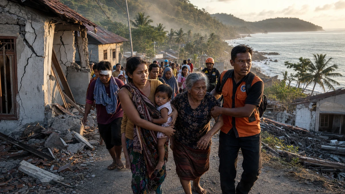
Image to help understand the article
A powerful quake, a fast-moving warning and a still-changing picture
A powerful 7.7 magnitude earthquake struck off the northern coast of Indonesia’s Flores Island at about 5:58 a.m. local time on the 15th, killing two people and forcing thousands to evacuate, according to Indonesian disaster authorities and international wire reports. A tsunami warning that was briefly issued after the quake has since been lifted, but the end of that alert does not mean the danger, damage assessment or humanitarian response is over.
What stands out in this disaster is not just the headline magnitude, although 7.7 is large by any standard. It is the combination of factors that made the quake especially alarming in the first hours: strong shaking, a shallow depth of about 10 kilometers, and an offshore location close enough to populated coastal areas to raise immediate concerns about tsunami risk. The U.S. Geological Survey and the European-Mediterranean Seismological Center placed the epicenter in the sea roughly 68 kilometers northwest of Ende, a city on Flores.
That combination helps explain why authorities moved quickly to warn residents and why evacuation numbers grew as more information came in. Early reports often focus on the most visible number, in this case the magnitude. But in earthquake response, the more revealing questions are often where the quake occurred, how deep it was and who was in harm’s way when it hit. On those measures, this was the kind of event that demanded an urgent response even before officials could confirm exactly where the deaths had occurred or how extensive the onshore damage might be.
For American readers, that distinction may sound familiar. In the United States, people tend to understand hurricane categories or wildfire acreage as shorthand for danger, but seismologists and emergency managers know that a single number can be misleading. A quake’s destructive potential depends on geology, depth, building standards, distance from population centers and whether it triggers secondary threats such as landslides or tsunamis. In Indonesia, a sprawling archipelago on one of the world’s most active seismic belts, those layers of risk are a routine part of life and disaster planning.
The result is a story that is bigger than one morning’s tremor. This quake offers a real-time case study in how modern disaster response works: the scientific networks that detect and revise earthquake data, the public alert systems that must err on the side of caution, and the difficult hours afterward when casualty figures, evacuation totals and damage assessments remain incomplete. The tsunami warning has been lifted. The uncertainty has not.
Why depth and location mattered more than the magnitude alone
The public tends to fixate on magnitude because it is the easiest earthquake statistic to understand. Bigger number, bigger quake. But emergency officials do not respond to magnitude alone, and neither should readers trying to make sense of the event.
In this case, the quake’s depth was reported at about 10 kilometers, making it shallow. That matters because shallow earthquakes generally transfer more energy toward the surface than deeper ones do. A 7.7 quake deep underground can still be dangerous, but a shallow offshore quake near coastal communities raises more immediate concern for strong shaking and sudden changes in sea level. That is why authorities had to evaluate two threats at once: damage on land from the shaking and the possibility of a tsunami offshore.
The location also mattered. The epicenter was offshore, near Flores Island, not in an empty patch of ocean far from population centers. With a coastal event, officials must quickly decide whether people should move inland or to higher ground, often before they can be sure whether a major wave will follow. That is one reason tsunami alerts can feel both urgent and imprecise. They are designed to buy time in the narrow window when hesitation can cost lives.
For readers in the United States, there is a useful comparison with earthquake and tsunami planning along the Pacific Coast, especially in Alaska, Hawaii, Washington, Oregon and California. Americans living in those regions know that warnings are not predictions of guaranteed catastrophe; they are protective measures triggered by a dangerous set of conditions. The same logic applies here. A lifted warning means the feared ocean threat appears to have diminished. It does not erase the fact that the shaking itself may already have caused fatalities, structural damage, injuries and prolonged disruption.
That distinction is especially important because the earliest coverage of disasters often compresses many different realities into one headline. A strong quake can be both less catastrophic than initially feared in one respect and more serious than assumed in another. Here, the tsunami threat receded enough for the warning to be lifted, yet two deaths were confirmed and thousands of people had already been displaced. Those facts are not contradictory. They describe different parts of the same emergency.
Why the numbers kept changing in the first hours
One of the most important lessons from this quake is also one of the hardest for audiences to absorb in the social media era: the first numbers are usually not the final numbers. That is not evidence that officials or news outlets are unreliable. It is how disaster reporting works.
In the immediate aftermath of a major earthquake, scientific agencies and local governments are measuring different things on different timelines. Seismological institutions such as the U.S. Geological Survey can estimate magnitude, depth and location relatively quickly through sensor networks. Those values may still be refined, but they often arrive faster than human impact data. By contrast, casualty counts, evacuation totals and infrastructure damage have to be gathered by local authorities, emergency workers and local governments scattered across affected areas.
That appears to be what happened in Indonesia. Early information about the time of the quake was later clarified to around 5:58 a.m. Evacuation totals were first reported in the hundreds and later expanded into the thousands as the scale of the response became clearer. Indonesian authorities confirmed two deaths, one male and one female, while saying the exact locations where they died on Flores had not yet been released.
For journalists, this is a familiar rhythm. In the first stage, the story is that a strong quake happened. In the second, the focus shifts to warnings, evacuations and immediate public safety. In the third, attention turns to what happened on land: who died, who was injured, what broke, what remains unsafe and what secondary risks remain. Those stages can overlap, and new information can make earlier reporting look incomplete. In reality, it reflects the staggered way that evidence becomes available.
American readers saw similar patterns during major hurricanes on the Gulf Coast, wildfires in California and even earthquake scares in Alaska and Hawaii. At first, officials talk about trajectories, magnitudes or warning zones. Only later do the harder and more emotionally consequential details emerge: which neighborhoods flooded, which roads failed, which hospitals lost power, which families were displaced. The lag is not a flaw in the system. It is the consequence of trying to build an accurate picture while people are still moving to safety.
That is why readers should separate the meaning of each number. The reported 5:58 a.m. time refers to when the quake struck. The 7.7 magnitude measures released energy. The 10-kilometer depth speaks to how strongly that energy may have been felt at the surface. The roughly 68-kilometer distance from Ende indicates geographic proximity to a known population center. The thousands evacuated reflect the scale of precautionary action, not necessarily the number of injured people. And the two confirmed deaths represent only the officially verified human toll so far, not necessarily the final count.
Tsunami warning lifted does not mean the crisis is over
One of the easiest mistakes in disaster coverage is to treat the lifting of a warning as the end of the story. In public life, alerts create a simple narrative arc: a threat appears, officials warn the public, then the warning is canceled and life returns to normal. Real emergencies rarely work that cleanly.
In this case, the tsunami warning was lifted, meaning authorities no longer believed a major wave posed the same immediate danger to coastal areas. That is important and reassuring news. But it addresses only one category of risk. The quake itself had already happened. Aftershocks were reported. People had fled their homes. Two deaths had been confirmed. And officials were still working to determine exactly where the fatalities occurred and whether there was additional damage on land.
That is an important distinction in any coastal disaster, whether in Indonesia, Japan, Chile or the United States. A tsunami warning is about one specific hazard: abnormal sea behavior capable of causing severe coastal flooding and destruction. It is not a summary judgment on whether the broader emergency has passed. Buildings may still be unstable. Roads may be cracked. Utilities may be disrupted. Schools and clinics may need inspection before reopening. Families who evacuated may not be able to return immediately, especially if aftershocks continue.
For Americans, the closest parallel may be what happens after a tornado warning expires or a hurricane storm surge alert is lifted. The official message is no longer “take cover now,” but that does not mean every danger has ended. Power lines may be down. Floodwaters may still be rising elsewhere. Emergency crews may still be trying to reach people in damaged areas. In earthquake zones, the same logic applies: the first danger may have passed while the second phase of the emergency is just beginning.
That second phase often gets less attention because it is slower, messier and harder to visualize than the dramatic first alert. Yet it is where much of the real human cost becomes clear. Did houses crack or collapse? Were ports, runways or hospitals affected? Were fishing communities or coastal villages cut off? Did fear of a tsunami push people into hasty evacuations that created new logistical problems? Those are the questions that determine whether an event becomes a brief scare or a prolonged disaster.
So the right way to read the latest updates is not that the danger vanished, but that one feared scenario appears not to have materialized at the worst scale. That matters. It is just not the whole story.
What this means for the United States
Even though this earthquake struck in Indonesia, it carries important lessons and implications for the United States, especially for American disaster planners, scientists, businesses and communities tied to the Indo-Pacific.
First, the event underscores the central role of U.S. scientific institutions in global disaster monitoring. The U.S. Geological Survey was one of the key organizations providing core data on the quake’s magnitude and depth. For many Americans, USGS is a domestic agency associated with California fault lines, Yellowstone speculation or volcano updates in Hawaii and Alaska. But it also serves as part of a broader international information system that helps governments, media outlets and the public understand fast-moving seismic events around the world. In a globally connected media environment, American institutions are not just local actors; they are part of the first draft of international disaster response.
Second, the quake is a reminder that U.S. interests in Asia are not limited to geopolitics in the narrow military or diplomatic sense. Southeast Asia sits along critical shipping lanes and trade routes, and Indonesia is one of the region’s largest economies. A major natural disaster there matters to the United States because supply chains, travel, humanitarian coordination and regional stability all intersect more than they once did. American companies source goods from across Asia, U.S. airlines and tourism industries are tied to Pacific travel patterns, and Washington has made the broader Indo-Pacific a central part of its foreign policy framework. Natural disasters are part of that strategic environment.
Third, the earthquake offers a cautionary lesson for U.S. coastal communities that face similar low-probability but high-impact risks. The West Coast, Alaska and Hawaii all operate under the possibility that an offshore quake could force quick decisions about evacuation. The details differ from place to place, but the public communication challenge is remarkably similar: warn early enough to save lives without pretending that the first alert contains all the answers. Americans who have grown used to phone alerts, weather maps and evacuation zones can see in Indonesia a version of the same tension their own officials would face under pressure.
Fourth, this is relevant to the large Indonesian and broader Asian diaspora communities in the United States, especially in places with strong Pacific ties such as California, Washington, Texas, New York and Hawaii. For immigrant families and transnational communities, disasters abroad are not distant abstractions. They are deeply personal events followed through a mixture of local American news, social media, messaging apps and international wire reports. The changing early numbers in a disaster can create a difficult emotional whiplash: initial fear, partial relief, renewed concern and a long wait for specifics. That is a familiar experience to many diaspora communities in the U.S. whenever catastrophe strikes overseas.
Finally, the quake reinforces a broader point for American audiences: resilience is not just about engineering. It is also about trust in institutions, public understanding of risk and the ability to act on incomplete information. Whether the setting is Flores Island, the Oregon coast or Honolulu, the same question keeps surfacing: will people move when they are told to move, even if the worst-case scenario may not happen? That is not only a scientific problem. It is a civic one.
Indonesia’s geography makes these disasters recurring, not exceptional
To understand why this earthquake matters, Americans should also understand why Indonesia experiences events like this so often. The country is an immense archipelago stretching across a tectonically volatile region where several major plates interact. It sits on the Pacific Ring of Fire, the same broad seismic belt that affects Japan, the Philippines, Alaska and the western coasts of the Americas. In practical terms, that means earthquakes, volcanic eruptions and tsunami threats are not rare anomalies. They are recurring features of national life.
That geographic reality shapes how Indonesia responds to danger. Authorities have to make rapid decisions in a country made up of thousands of islands, many with coastal populations and uneven infrastructure. Communication itself can be a challenge. A warning must move quickly across local jurisdictions. Evacuations may mean getting people uphill, inland or away from fragile coastal zones before dawn, before transportation is fully running or before all facts are known.
For American readers, the closest broad comparison is not one single state but a patchwork of risk zones: California for earthquakes, Hawaii for tsunamis, the Gulf Coast for evacuation logistics and Puerto Rico for the challenge of disaster response across islands. Indonesia combines aspects of all of those into one national setting. That does not make any one event predictable in its details, but it does explain why authorities often act aggressively in the opening moments of a crisis.
It also helps explain why casualty and displacement figures can evolve quickly. In a country with dispersed coastal communities, the first reports may reflect only what officials know from the easiest-to-reach areas. As information comes in from farther afield, the picture can widen. That appears to be part of what happened here, with evacuation totals increasing from hundreds to thousands as the response took shape.
None of that should be mistaken for bureaucratic confusion alone. In a disaster, incomplete information is normal. The real question is whether the system can absorb new information fast enough to protect people. The fact that thousands evacuated after the warning suggests that the alert and response machinery was operating at a significant scale, even if the full details of land damage remain unresolved.
What to watch next
The most important developments from here will not be new headline-grabbing geology, but the slower work of verification. Officials still need to determine the exact locations tied to the confirmed deaths, assess whether additional casualties or injuries occurred, and establish the extent of damage to homes, roads, utilities and public infrastructure on Flores and nearby areas. Aftershocks will also matter because they can complicate inspections and delay people’s return home.
Readers should also watch for the difference between precautionary evacuation and prolonged displacement. Thousands of people leaving coastal areas in response to a tsunami warning is a sign of a functioning emergency response. But the longer those evacuees remain displaced, the more the story shifts from warning systems to humanitarian needs. Shelter, clean water, medical access, transportation and communications all become more pressing if people cannot quickly return.
Another point to watch is how officials communicate updates once the initial global attention fades. In many disasters, the world remembers the magnitude but loses track of the aftermath. Yet the after-action stage often reveals the most meaningful lessons: whether damaged communities received adequate support, whether warning systems reached the most vulnerable residents, and whether early data helped or hindered public understanding.
For U.S. readers, the larger takeaway is not simply that a powerful earthquake happened in Indonesia. It is that modern disasters unfold as information problems as much as physical ones. Scientific agencies, local authorities, international media and anxious publics all move at different speeds. The challenge is to keep those speeds aligned enough to save lives without turning every update into a false sense of certainty.
The Flores quake is a reminder that the world’s most dangerous natural events are often understood backward: first by their biggest number, then by their immediate warning, and only later by their actual human impact. In this case, the biggest lesson may be that the most useful facts were never just “7.7.” They were the depth, the offshore location, the quick evacuation, the lifted tsunami warning, the confirmed deaths and the unresolved questions that remain after the shaking stops.
Comments
Post a Comment