South Korea’s New Land Satellites Signal a Bigger Shift: Space Data Is Becoming National Infrastructure
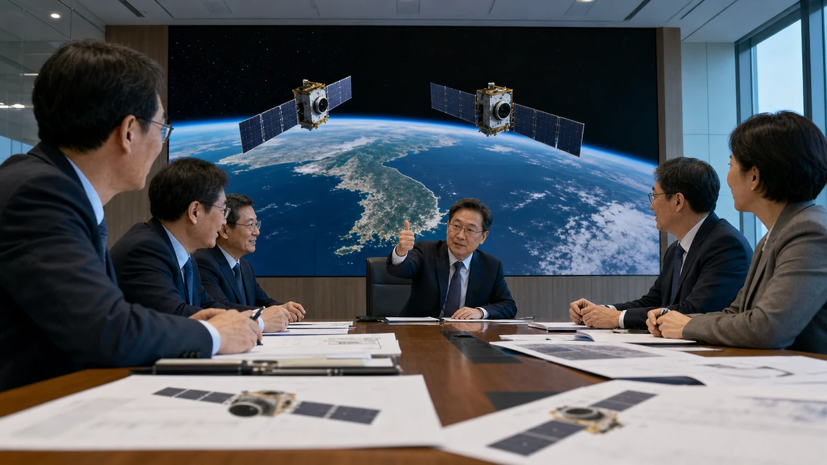
Image to help understand the article
South Korea clears a key hurdle for two new high-resolution land satellites
South Korea has moved a step closer to expanding one of the less flashy but increasingly important parts of its national space program: the steady, repeated watching of its own territory from orbit.
The country’s proposed development of two new high-resolution “land satellites,” known domestically as National Land Satellites 3 and 4, has passed a preliminary feasibility review, according to the Korean news summary and Yonhap News Agency. In South Korea’s budgeting system, that review is more than bureaucratic paperwork. It is a major gate for projects that require significant public spending, and passing it signals that the government has formally recognized the project as worthy of national investment.
The plan is not limited to building two satellites. It includes the full chain of work: manufacturing, launching and operating the spacecraft, then turning the imagery they collect into usable spatial information for land management and public data systems. That structure matters. It suggests Seoul is thinking less about a one-off technological trophy and more about building a durable pipeline from space hardware to everyday state capacity.
For American readers, the easiest comparison is to the way satellite imagery in the United States has evolved from a niche government tool into a backbone for everything from weather forecasting and wildfire tracking to crop monitoring, logistics, insurance assessments and commercial mapping. South Korea’s latest move points in a similar direction. The headlines may focus on the satellites themselves, but the deeper story is about data: who collects it, how reliably it is updated, and whether it can be turned into something valuable for government agencies, researchers and eventually businesses.
That helps explain why this development deserves attention beyond South Korea’s space community. In an era when countries are racing to secure critical technologies, Earth observation is becoming a form of strategic infrastructure, not unlike broadband networks, electric grids or advanced semiconductor capacity. The satellite is the visible object. The real asset is the information system around it.
The Korean summary did not include a project budget, launch schedule or technical specifications beyond the description of the satellites as high-resolution systems. But even with those details still missing, the significance of the decision is clear: South Korea has now officially placed satellite-based land monitoring within its national investment priorities.
Why these satellites matter beyond the launch pad
The Korean article makes a notable point that is often lost in public discussion of space programs. The value of Earth observation satellites does not end once a rocket reaches orbit. In many ways, that is where the real work begins.
Governments use land-observation imagery to watch for changes that are difficult to track consistently from the ground. That can include urban expansion, transportation corridors, shoreline shifts, flood damage, forest conditions and other changes in the physical landscape. Repeated imagery over time allows agencies to compare one moment to another, helping them move from anecdotal impressions to systematic monitoring.
South Korea’s project, as described, is designed to connect three linked functions: observing the country, building spatial information and providing that information for public use. “Spatial information” may sound abstract to many American readers, but it is essentially location-based data that can be layered, analyzed and used for planning or services. Think of the data that underpins digital maps, zoning analysis, infrastructure planning, environmental review and disaster response. The more accurate and current the imagery, the more useful those downstream tools become.
This is why the project’s structure matters as much as the satellites themselves. A satellite program centered only on hardware can become a prestige exercise. A program built around observation, operations and practical use has a better chance of producing measurable public value. The Korean summary explicitly frames the investment as a way to connect space assets with terrestrial information systems. That is a strong sign that policymakers are trying to build an ecosystem rather than just launch another spacecraft.
There is also an economic logic here. Satellite manufacturing requires one set of capabilities: precision engineering, systems integration and testing. Operating a satellite requires another: mission control, data handling, image processing and reliability over time. Once imagery is collected, a third value chain can emerge around software, research, analytics and applied services. That means the same public investment can potentially support multiple layers of industrial activity, even if the immediate customer remains the state.
The Korean government, according to the summary, expects the resulting spatial information to help stimulate related industries and research and development. The source material does not identify which companies or sectors may benefit, and it does not quantify the likely market impact. Still, the policy direction is familiar. Governments across advanced economies increasingly see public data systems as a way to catalyze private innovation later. In other words, the state funds the base layer, and companies build tools and services on top of it.
Whether that works will depend on execution. Data has to be reliable, standardized, accessible in useful formats and delivered consistently enough for agencies, universities and companies to trust it. A satellite can produce images; an information ecosystem has to turn those images into decisions.
South Korea’s broader space strategy is coming into focus
This decision also says something larger about where South Korea appears to be heading as a space actor.
For years, much of the global attention around national space programs has gone to dramatic milestones: rocket launches, lunar ambitions, military satellites or human spaceflight. Those stories are easy to tell because they are visually compelling and politically symbolic. But mature space power is often built on quieter capacities that become routine over time. Reliable Earth observation is one of them.
The Korean summary suggests that Seoul is moving beyond a narrow focus on launch or satellite construction as isolated achievements. Instead, it is tying together development, operation and application into a single public investment framework. That is significant because it reflects a more integrated understanding of what national space capability actually means.
South Korea is not alone in making that shift. Around the world, governments are increasingly asking not just whether they can put an object in orbit, but whether they can use orbital assets to improve domestic governance, industrial competitiveness and technological sovereignty. In that sense, the two new land satellites fit into a larger international trend: countries want their own trusted streams of geospatial data, particularly at a time when supply chains, climate events and security concerns are all putting pressure on state planning.
For South Korea specifically, the move aligns with the country’s long-established development model. Seoul has often pursued advanced technology not as a standalone symbol of modernity, but as part of a broader industrial strategy that links state planning, domestic technical capacity and export-oriented growth. Americans are more familiar with how that model played out in cars, shipbuilding, electronics and semiconductors. Space and geospatial data may be following a similar path, even if at a smaller scale.
The Korean report also notes an important distinction in how public investment should be judged. Unlike a physical facility whose benefits may be concentrated in one region, satellite imagery can be reused across multiple agencies, research fields and industries. That makes measuring success more complicated. The test is not simply whether the satellites are built on time. It is whether the imagery becomes a living, productive public resource.
That distinction is worth watching because it reflects a wider debate in many countries, including the United States: Should public technology projects be evaluated mainly as construction efforts, or as long-term data and service platforms? South Korea’s land satellite project appears to lean toward the latter.
What this means for the United States
For Americans, the significance of South Korea’s move is not just that another U.S. ally is investing in space. It is that a close technological partner is deepening its capabilities in an area that increasingly overlaps with U.S. commercial, scientific and strategic interests.
The United States already has a mature Earth observation ecosystem, including government programs such as Landsat and a strong commercial imagery market led by private firms. Americans are accustomed to satellite-based products showing up in daily life almost invisibly — in map apps, storm tracking, precision agriculture, traffic planning and disaster coverage on television. South Korea’s investment underscores how that model is spreading: allied economies increasingly want not only access to satellite data, but stronger domestic ownership of the collection and operational pipeline.
That has several implications for the United States.
First, it creates more opportunities for cooperation. The U.S.-South Korea alliance has expanded well beyond traditional defense issues in recent years, with growing attention to semiconductors, batteries, advanced manufacturing and critical technologies. Geospatial information and satellite operations fit naturally into that broader agenda. A South Korea with stronger domestic land-observation capacity could become a more capable partner in areas such as disaster monitoring, environmental research and regional data-sharing.
Second, it reflects the growing sophistication of a market where American companies already play a major role. U.S. firms are deeply embedded in the global space economy, from launch services and components to analytics and software. As more allied countries build structured demand for high-quality imagery and geospatial services, American companies may find new partnership or competition dynamics, depending on how local procurement rules and industrial policies evolve. The Korean summary does not identify commercial participants, so it would be irresponsible to predict specific contracts or business winners. But the direction is unmistakable: Earth observation is becoming more economically important, not less.
Third, American audiences should see this as part of a larger pattern in allied tech policy. Washington has spent years encouraging trusted partners to build capacity in strategically important sectors rather than relying excessively on a narrow set of foreign suppliers. Satellite-based geospatial infrastructure belongs in that conversation. Just as the U.S. now talks about “friend-shoring” for chips and battery materials, one can imagine a future in which trusted data networks and observation systems also matter more in alliance planning.
There is also a cultural angle here for American readers who primarily encounter South Korea through K-pop, Korean dramas and consumer brands. The Korean Wave has made South Korea highly visible in U.S. popular culture, but it can sometimes flatten the country into an entertainment powerhouse alone. Stories like this one are a reminder that the same country exporting chart-topping music and hit streaming shows is also trying to expand its position in advanced infrastructure, industrial technology and state-led innovation. For an American audience, that broadens the image of South Korea from cultural trendsetter to full-spectrum technological player.
In U.S. terms, the comparable shift is easy to grasp: imagine if a state government were not just buying better maps, but funding an integrated system that combines satellites, public data architecture and economic development goals. South Korea is doing that at a national level.
The real competition is over data ecosystems, not just satellites
One of the most important takeaways from the Korean summary is that the project is being presented as an ecosystem investment. That language matters because it captures the direction of the global space economy.
For much of the space age, prestige centered on possession: who had rockets, who had satellites, who could reach orbit first. Today, value is increasingly created by integration. The countries and companies that stand to benefit most are those that can link observation, software, storage, analysis and end-user services into something dependable and scalable.
In practical terms, that means the competition is no longer only about who can build a spacecraft. It is about who can create a functioning pipeline from raw imagery to useful insight. In the United States, that lesson has already reshaped industries. Farmers use satellite-informed tools to assess crop conditions. Insurance companies examine imagery after storms. Municipal planners use geospatial analysis to understand growth patterns. Researchers combine remote sensing data with climate and environmental models. Ordinary consumers use maps and location services without thinking much about the orbital infrastructure behind them.
South Korea appears to be trying to strengthen that same kind of chain. The summary repeatedly emphasizes not only observation, but also the construction and provision of spatial information. That is the language of a country trying to turn space-derived imagery into a routine input for governance and innovation.
This is where the project could have effects far beyond a single ministry or budget cycle. If the data is regularly updated and made useful to researchers and industry, it could help create domestic habits of use. Universities might incorporate it into research programs. Startups might build applications around it. Public agencies might become more data-driven in land administration. None of that is guaranteed, and the source material does not claim those outcomes have already arrived. But it is clearly the policy logic behind the investment.
For American readers, there is a familiar lesson here: infrastructure in the digital age is often invisible until it becomes indispensable. The same way cloud computing or GPS moved from specialist systems to everyday utilities, Earth observation can evolve from a government niche into a platform others build on. South Korea’s decision signals that Seoul wants to be stronger in that platform layer.
What to watch next
Because the Korean summary does not provide a budget, timeline or launch vehicle details, the next phase of the story will be about execution and transparency. Passing a preliminary feasibility review is a major milestone, but it is not the final measure of success.
The first question is whether the government can maintain coherence across the full life cycle of the project. It is one thing to fund satellite development; it is another to sustain operations, data processing and user delivery after launch. Around the world, some public technology projects falter not because the hardware fails, but because the support systems around it remain underdeveloped or fragmented.
The second question is accessibility. If South Korea wants the satellites to stimulate industry and research, then the resulting data will need governance rules that encourage practical use while protecting legitimate state interests. The summary makes clear that the government sees industrial and research benefits as part of the rationale. The eventual impact will depend on whether those users can actually integrate the information into their own work.
The third question is strategic positioning. South Korea is entering a period in which advanced technology policy increasingly overlaps with geopolitics. Satellites, chips, batteries, artificial intelligence and data systems are no longer separate policy silos. They are part of a broader contest over resilience, competitiveness and trusted supply chains. The land satellite project may look technical, but it belongs to that wider landscape.
Finally, there is the question of public narrative. Space programs are often sold to voters through national pride, but their staying power usually depends on practical value. If South Korea can show that its satellites improve land management, strengthen public information and support research and industry, that would make the investment easier to defend over time. If the project remains abstract, it may be harder to translate technological promise into lasting public support.
For now, the clearest conclusion is this: South Korea has signaled that watching its own territory from space — and converting those observations into usable, shareable information — is important enough to merit serious national investment. For Americans, that is worth reading not as an isolated Korean budget item, but as evidence of a broader global shift. In the 21st century, space is no longer just about exploration or prestige. It is increasingly about who owns the systems that help countries understand, manage and compete on Earth.
Comments
Post a Comment