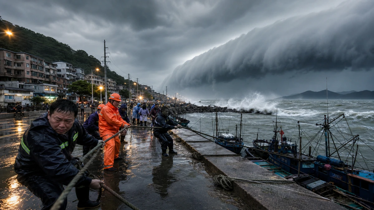
Image to help understand the article
A major storm is bearing down on one of China’s most densely populated coastal corridors
Authorities in China have ordered large-scale evacuations, halted ferries and construction at sea, suspended flights and rail service, and closed major tourist attractions as Typhoon Dolphin approaches the country’s eastern coast. Chinese forecasters say the storm is expected to come ashore between Zhejiang and Fujian provinces, an economically vital stretch of coastline south of Shanghai, with landfall anticipated between Friday evening and early Saturday local time.
China’s Central Meteorological Observatory raised its typhoon warning to red, the highest level in the country’s four-tier weather alert system, signaling the seriousness of the threat before the storm reaches land. For American readers, that kind of warning can be understood as the rough equivalent of the most urgent pre-landfall messaging seen ahead of major hurricanes in states such as Florida or Louisiana, when emergency managers begin treating the storm not as a possibility but as an imminent public safety event.
What makes Dolphin especially concerning is not only where it is expected to make landfall, but how wide its impact may be. Forecasters say the storm is likely to bring intense rain and dangerous winds not just to the immediate coast, but across a broad swath of eastern China, including Shanghai and inland provinces. Officials have warned that parts of Zhejiang could see between 250 and 500 millimeters of rain — roughly 10 to 20 inches — an amount that raises the risk of urban flooding, flash floods, landslides and major transportation disruption even after the storm itself begins to weaken.
That broader rain threat is central to the story. In the United States, the public often focuses first on whether a hurricane makes a direct hit. But emergency officials increasingly stress that weakening after landfall does not mean the danger is over. The same is true here. Chinese authorities are signaling that even if Dolphin loses strength after moving ashore, the inland flooding threat could continue well beyond the moment of landfall, affecting cities, transport networks and millions of residents far from the exact point where the eye crosses the coast.
The unfolding response offers a window into how China handles large-scale weather emergencies in a heavily populated region where ports, factories, airports, rail lines and tourism infrastructure sit close to the water. It is also a reminder of a global reality that Americans know all too well: extreme weather does not stay neatly contained. A single storm can quickly ripple through supply chains, transportation systems and daily life across multiple provinces or states at once.
Nearly 100,000 people have already been moved out of harm’s way
In Fujian province, which sits along the Taiwan Strait and is directly exposed to storms moving in from the Pacific, officials said 98,900 residents had been evacuated as of 6 p.m. Thursday. That figure — nearly 100,000 people moved before the expected landfall window — underscores how aggressively local governments are trying to reduce the number of people exposed to the storm’s most dangerous effects.
Mass evacuation before a storm is not unusual in typhoon-prone parts of East Asia, but it can look different from what Americans may associate with evacuation orders on the Gulf Coast. In China, evacuations are often carried out through a highly organized, state-directed system involving local neighborhood committees, village officials and workplace management structures, especially in coastal or lower-income communities where people may live in housing more vulnerable to wind or flooding. The goal is not simply to advise residents to leave, but to physically relocate large numbers of people to designated safer areas before travel conditions deteriorate.
That timing matters. Once wind intensifies and roads begin to flood, the act of evacuating can itself become dangerous. Chinese officials appear to be acting on the principle that the safest rescue is the one that never has to happen. By moving people early, they reduce the chance that emergency responders will later be forced into high-risk operations during the worst of the storm.
The evacuation number also suggests that authorities are not treating Dolphin as a routine summer storm. Rather, they are responding as if multiple systems of exposure need to be cut off at once: residents in flood-prone areas, workers on offshore projects, travelers using coastal transport routes and visitors gathered at major public venues. The coordination involved in moving that many people on short notice is substantial, and it points to the scale of the anticipated disruption.
For residents, evacuation can mean leaving home with little certainty about when they will return or what condition their neighborhood will be in afterward. That uncertainty is familiar to communities from Texas to the Carolinas, where storm warnings can quickly turn into days of displacement. The basic human stakes are the same whether the storm is called a hurricane in the Atlantic or a typhoon in the western Pacific: protecting lives first, then worrying about property damage later.
Air, rail and sea travel are being shut down in layers
The transportation response to Dolphin is notable not only for its scale, but for how many different forms of travel are being restricted at the same time. In Ningbo, a major port city in Zhejiang province, the local international airport said it would suspend all flights through Saturday. Chinese railway authorities also said some passenger train service between Fujian and Zhejiang would be suspended, limiting overland travel along a key stretch of the coast.
At sea, the clampdown is even broader. Coastal ferry routes have been halted, and all offshore construction work has been suspended. Those measures reflect a simple reality: water-related activity becomes extraordinarily dangerous once a typhoon nears land, especially in areas where storm surge, rough seas and sudden wind shifts can trap workers or passengers with little room for error.
For an American audience, it may help to think of this as the equivalent of simultaneously grounding regional flights, canceling selected Amtrak corridors, stopping commuter ferry traffic and shutting down offshore industrial operations ahead of a major storm. It is a layered strategy designed to keep people from being stranded in the wrong place at the wrong time — and to keep more people from entering the affected zone as the weather worsens.
Such shutdowns have consequences that extend well beyond inconvenience. When an airport stops all service, trains are canceled and ferries stop running, the result is not just delayed vacations or missed meetings. It can also disrupt freight movement, labor schedules, family travel, business operations and emergency logistics. Eastern China’s coast is one of the most economically active regions in the world, home to manufacturing centers, shipping routes and huge urban populations. Storm-related transport controls there can carry economic effects far beyond the communities closest to the shoreline.
The combination of restrictions also reflects something emergency planners in many countries have learned from hard experience: partial measures can leave dangerous gaps. Evacuating residents but keeping marine operations active still leaves workers exposed. Stopping ferries but delaying evacuations can trap people later when travel becomes impossible. By stacking the restrictions together, authorities appear to be trying to build a continuous defensive line rather than relying on piecemeal decisions.
Even Shanghai, north of the expected landfall zone, is bracing for heavy rain
One of the clearest signs that officials are preparing for more than a narrow coastal hit is the shutdown of major attractions in Shanghai, China’s largest city and one of its most visible international destinations. Shanghai Legoland Resort said it would suspend operations Friday evening, and Disney Resort in the city said it would close later that night.
For readers in the United States, a Disney closure can serve as a kind of shorthand for the seriousness of a weather threat. Theme parks do not stop operations lightly, particularly during busy travel periods. Closing them ahead of the worst weather helps clear large crowds, protect workers and give visitors time to return to hotels or homes before conditions become hazardous.
Shanghai is north of the expected landfall area between Zhejiang and Fujian, but it remains within the projected zone for heavy rain through Saturday afternoon. That matters because in big modern cities, the main danger from a storm is not always the dramatic image of buildings battered by wind. It can be the more mundane but equally destructive combination of flooded streets, overwhelmed drainage systems, transit disruptions and the knock-on effects of sending millions of people home early or keeping them from commuting at all.
In this sense, Shanghai’s response mirrors how large U.S. metropolitan areas prepare for severe weather even when they are not in the center of the forecast cone. City officials and private operators make decisions based not only on the storm’s track, but on how rainfall, crowd density and transportation networks intersect. A city can avoid the worst winds and still face a serious public safety challenge if roads flood, subways are disrupted or large entertainment venues remain open too long.
The inclusion of Shanghai in the rain warning area also illustrates how weather alerts often outgrow the public’s initial mental map of a storm. People tend to focus on the place most likely to take landfall. But the zone of practical disruption — where schools close, transportation stops, parks shut down and residents are told to stay indoors — can be much larger. That appears to be the case with Dolphin, whose impact is expected to radiate northward and inland beyond the immediate coastline.
Why the rain may matter more than the wind after landfall
Chinese meteorological authorities have said Dolphin is expected to weaken gradually after coming ashore and moving northwest. On paper, that may sound reassuring. In practice, it is only part of the picture. Tropical cyclones often remain dangerous after landfall because their rain bands can continue dumping water over already saturated ground, especially in mountainous or densely built regions.
That is why one figure in the forecast stands out: the possibility that some parts of Zhejiang could receive 250 to 500 millimeters of rainfall. Converted for U.S. readers, that is about 10 to 20 inches. Rainfall in that range can overwhelm drainage systems, flood roadways, inundate homes and factories, trigger mudslides and isolate communities even if sustained wind speeds begin to decline.
Americans have seen this pattern repeatedly in recent years, from Hurricane Harvey in Texas to inland flooding after storms that made landfall elsewhere on the Gulf or Atlantic coasts. The lesson is that storm intensity categories alone do not capture the full threat. Water is often the deadlier force, especially when it spreads far beyond the shoreline and lingers after the headlines move on.
Eastern China is particularly vulnerable to this kind of cascading impact because of the combination of dense development, river networks, mountainous terrain in some inland areas and large transportation corridors tying coastal cities to interior provinces. The forecast includes not just Zhejiang and Fujian, but also Jiangsu, Anhui and Jiangxi, along with Shanghai. That means the risk footprint spans multiple administrative regions, each with its own infrastructure pressures and emergency needs.
In practical terms, officials are preparing for a storm that could change character as it moves inland. What begins as a coastal wind-and-surge event may evolve into a widespread flooding emergency affecting highways, rail links, airports, industrial parks, farms and urban neighborhoods. That is one reason the highest alert level was issued before landfall rather than after damage reports started coming in. The message is preventive: reduce exposure now, because once the rain sets in across a broad area, response becomes more difficult and more dangerous.
A storm response that reveals how modern megaregions manage risk
Dolphin’s approach is also a case study in how governments manage disaster risk in large, interconnected coastal megaregions. The affected area is not a single isolated beach town. It is part of a vast corridor of cities, ports, factories and tourism hubs linked by highways, rail systems, airports and maritime traffic. When a storm threatens that kind of region, the question is not only where the eye will cross, but how to reduce exposure across multiple sectors at once.
That is what the current response in eastern China appears designed to do. Evacuations remove residents from the most vulnerable areas. Offshore work stoppages protect laborers in hazardous marine conditions. Ferry suspensions cut off a risky transport mode before seas worsen. Flight and rail cancellations reduce the chance of mass stranding. Tourist site closures empty out high-density public spaces. Taken together, those steps function less like isolated announcements and more like a coordinated effort to shrink the storm’s human footprint before impact.
There is also a political dimension, though not necessarily in a partisan sense familiar to Americans. In China, local governments are often judged heavily on their ability to anticipate and contain disasters, particularly when warnings are clear in advance. That can create strong incentives for sweeping preemptive action. While such measures can be disruptive and costly, officials may view that disruption as preferable to being seen as reactive once casualties or severe damage occur.
For global observers, the significance of this storm extends beyond weather maps. Eastern China is deeply embedded in international trade and manufacturing. Disruptions to port activity, airport operations and rail movement in the region can have downstream effects that touch supply chains well outside Asia. Although the immediate concern is public safety, the broader economic story may continue unfolding in the days ahead, depending on how severe the flooding becomes and how quickly transport links resume.
Climate scientists have long warned that a warmer atmosphere can hold more moisture, increasing the potential for extreme rainfall events. While no single storm can be reduced to climate change alone, Dolphin arrives in a world where communities from China to the United States are facing a familiar question with growing urgency: how do you protect dense, high-value coastal regions when storms are capable of bringing both destructive winds and historic rainfall?
What to watch in the hours after landfall
As Dolphin closes in, several factors will determine how severe the event becomes. The first is the exact timing and location of landfall. A shift north or south can redistribute the heaviest winds, surge and rain across different cities and transport corridors. The second is the storm’s forward speed. A faster-moving system may limit rainfall totals in some areas, while a slower one can prolong flooding risk. The third is how rain bands behave after landfall, especially over Zhejiang and neighboring provinces already under heavy-rain warnings.
Another key question is how long transportation restrictions remain in place. Airports, rail operators and ferry systems often resume service gradually, and only after safety inspections, weather clearance and in some cases debris removal or flood assessment. That means the most disruptive phase for travelers and businesses may not end when the winds subside. In many storm events, the aftereffects on mobility outlast the peak weather by many hours or even days.
Authorities will also be watching for the kinds of secondary emergencies that accompany major rain events: submerged underpasses, power outages, slope failures in hilly areas, flooded industrial zones and neighborhoods cut off by water. These are the less dramatic images that nonetheless define the real toll of a storm. They can complicate rescue efforts, delay the reopening of schools and workplaces, and keep evacuees from returning home quickly.
For now, the most important takeaway is that China’s eastern coast is not waiting to see what Dolphin does before acting. The red alert, the evacuations, the shutdown of marine work, the suspension of flights and trains, and the closure of high-profile attractions all point to the same conclusion: officials believe the storm poses a serious enough threat to justify widespread disruption before the first full effects are felt onshore.
That approach will be familiar to anyone who has watched preparations for a major hurricane in the United States. The names, agencies and geography may be different. The logic is not. When a powerful storm threatens a crowded coastline, the safest choice is often to empty vulnerable places early, shut down the systems that move people into danger, and prepare for a risk that extends well beyond the moment the storm makes landfall.
Comments
Post a Comment